Guttenberg, Iowa
2001 Flood
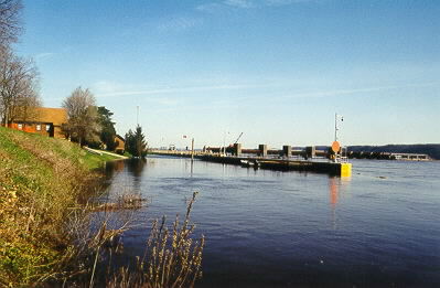
The Mississippi at downtown Guttenberg.
Guttenberg, Iowa2001 Flood |
The Mississippi at downtown Guttenberg. |
Many of Guttenberg's early settlers were German immigrants. Many of the buildings they built still stand. Today, visitors will find many antique and specialty shops in Guttenberg.
Flood crest 21.66 feet, Sunday, April 22, 2001 (second highest on record).
River at about 20.7 feet on April 24, when these photos were taken.
Damage: The dike built after the 1965 flood kept river water from entering Guttenberg. If the dike was not there, much of the city would have flooded, with extensive damage. The soil under the town is sand and gravel, and seepage was a problem. Some homes had water in basements from seepage. The historic downtown was undamaged, and businesses were open as usual.
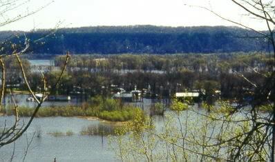
Most homes on Abel and Esmann Islands north of Guttenberg were flooded. Video of the flooded homes here was shown on national television news the week of April 15. Some homes here were built with the living quarters on the second floor and cement walls on the first floor to reduce flood damage.
All photos on this page copyright © Alan and Mary Ann Draves.
| Guttenberg's dike kept the city from flooding. | 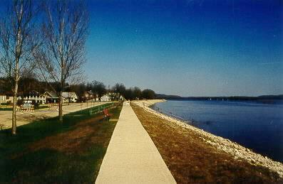
|
|
Pumping out the sewers in the north end of Guttenberg. |
| Marina Road and city marina, north of Guttenberg. | 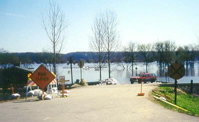
|
|
Most homes on Abel and Esmann Islands north of Guttenberg were flooded. |
| The road to Abel and Esmann Islands. Island residents would park here and take boats to their homes. | 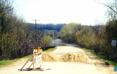
|
|
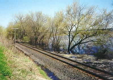
Flooding along the railroad tracks north of Guttenberg. |
Top | Go Downriver | Go Upriver | Home
2001 Mississippi River Flood Photos (From Guttenberg School)
Welcome to Guttenberg
Guttenberg Press (Guttenberg's newspaper)
River Roads - Guttenberg
This page maintained by Alan Draves.