Floating logs bent this lamppost along the Hastings riverfront.
Floating logs bent this lamppost along the Hastings riverfront.
|
Hastings is a fast-growing community located just above where the St. Croix River meets the
Mississippi. There are many historic buildings in and near downtown.
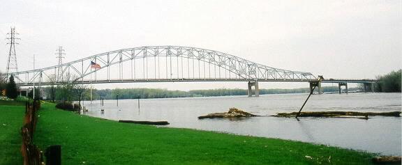
Flood crest 21.9 feet, Sunday, April 29, 2001 (second highest on record). Damage: Some homes along First St. may have had water in basements. The rest of Hastings is higher. Damage to hydroelectric plant at dam, and to parks along river. Damage estimate $251,000. A bit of personal history - my wife and I were married in Hastings in 1988, 13 years ago on the date these photos were taken. All photos on this page copyright © Alan and Mary Ann Draves. |
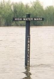 The river crested a couple feet below the record 1965 crest. |
| Lock and Dam Road was under water. At the left is Lake Rebecca, which has become part of the river. When not underwater, this park is a popular recreation area. | 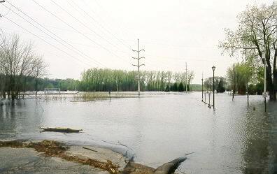
|
|
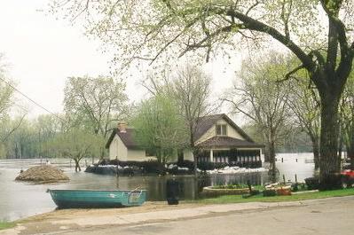
First Street east of downtown is the lowest part of Hastings. This home was wrapped in black plastic, and has a dike of sandbags and more plastic built around it. |
| Another sandbagged home on First Street. | 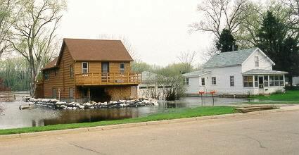
|
|
First and Franklin Streets. |
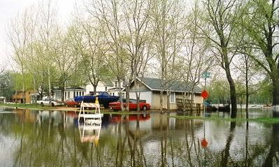
| This resident had two garages - one flooded, the other built well above flood level. | 
|
Top | Go Downriver | Home
1997 Mississippi River Flood at Hastings MN
Hastings on the Mississippi
Hastings Area Chamber of Commerce
Hastings Star-Gazette
River Roads - Hastings
This page maintained by Alan Draves.